Six tiers. One unified global grid.
We organize safety, cleanliness, and greening initiatives into precise geographical scales. Your local action maps directly to global visibility.
6
geographic scales
1
unified framework
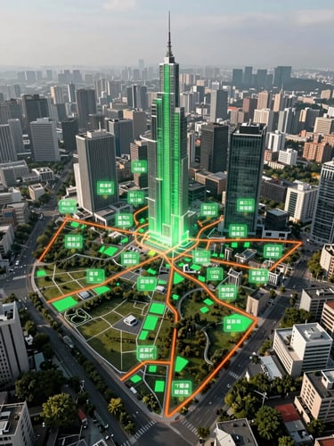
The Six Geographic Tiers
Our framework connects every street corner to continental alliances, ensuring no effort is lost.
Street Level
Suburb & Neighborhood
Individual blocks, street cleanups, and immediate neighborhood safety patrols.
Consolidated local groups managing shared parks, civic centers, and community green spaces.
City & Municipality
Region & State
Urban-wide coordination aligning with local municipal waste and safety frameworks.
Watershed restoration, regional trail networks, and state-level safety coordination.
Country & Continent
Global Grid
National environmental policies, continental flyway protections, and large-scale alliances.
The ultimate umbrella layer aggregating planetary data, resource distribution, and progress maps.

From block to globe
Every cleanup, safety initiative, and greening project logged at the street level feeds directly into regional databases. We don't replace existing organizations; we give them a structured framework to measure collective impact.
By aligning local data under a single geographic grid, we provide civic leaders and global alliances with verifiable, block-by-block progress reports.
Join the global grid
Register your local initiative today and connect with resources, coordinates, and alliances at every geographic tier.
Safe-Clean-Green.World
Organizing grassroots action on a global grid.
Sitemap
Home
Tiers
Alliances
Register
Global Grid
coordinator@safe-clean-green.world
Geneva + Remote Coordination
Register your local initiative today
© 2026 Safe-Clean-Green.World-A unified front for local safety and greening.
BLOCK-BY-BLOCK COORDINATION